Bay of Kotor Road Trip
A self-drive loop around the Bay of Kotor: out of Kotor along the inner shore through Dobrota and Perast, on to Risan's Roman mosaics, the full loop versus the Kamenari–Lepetane ferry shortcut, then Tivat and the high viewpoints — with honest notes on the narrow bay road, the car-free Old Town and where to park.

Photo: Laurynas Žižys / Unsplash
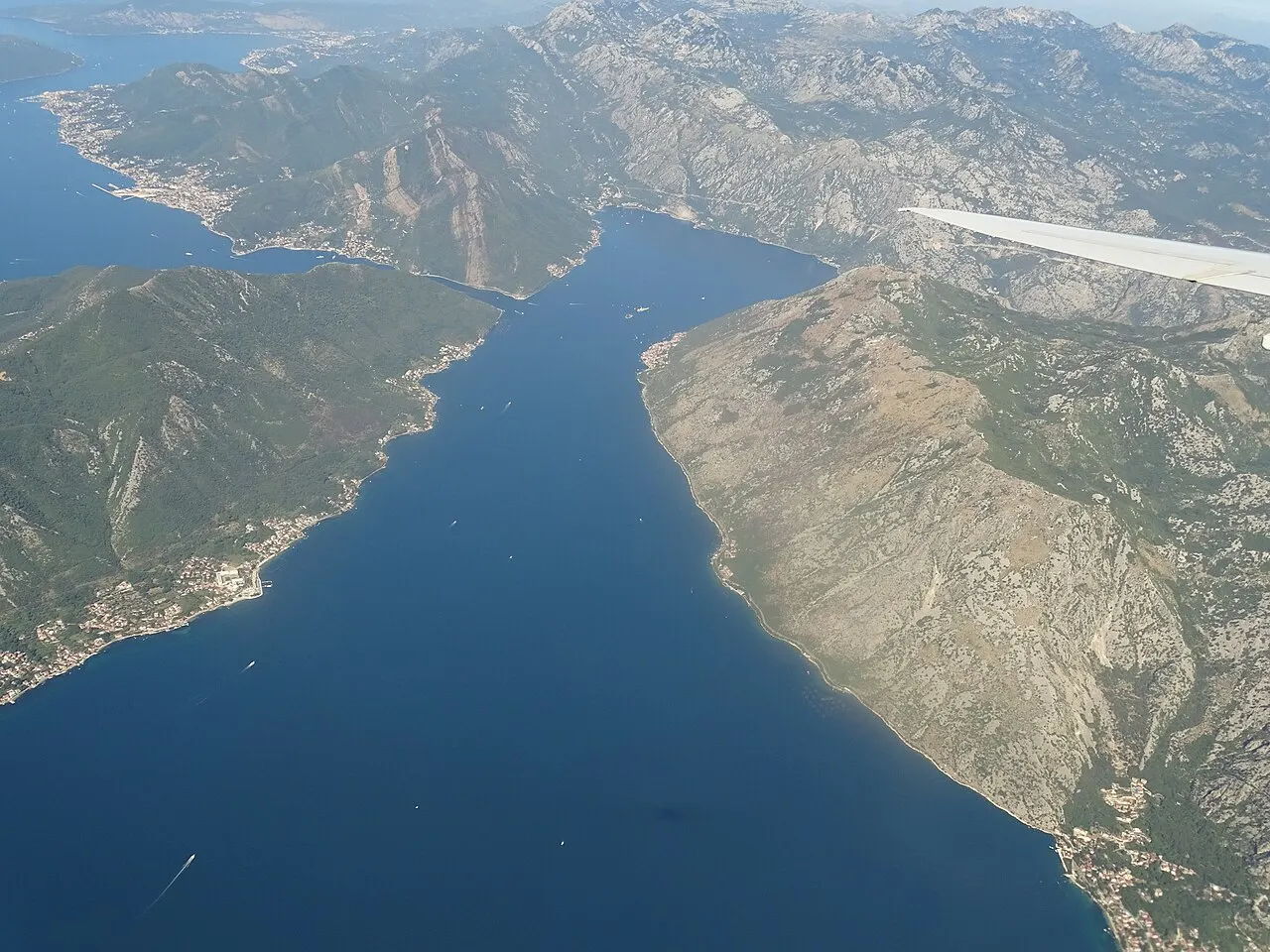
- ✓The Bay of Kotor is a flooded river canyon — about 28 km of water in four linked basins, narrowest at the 340 m Verige strait — and the shore road traces almost all of it.
- ✓The classic loop runs from Kotor through Dobrota and Perast to Risan, then either all the way around or across the bay mouth on the Kamenari–Lepetane ferry.
- ✓The ferry is the great shortcut: it saves a long drive around when you want to cut to Tivat, Herceg Novi or the road to Croatia.
- ✓Drive it slowly — the bay road is scenic but narrow, winding and busy in season, and the Old Town itself is car-free.
- ✓The best of the trip is the stopping, not the driving: Perast, the Roman mosaics at Risan, a bay-view lunch and the high viewpoints over the Boka.
Before you set off: what the bay road is really like
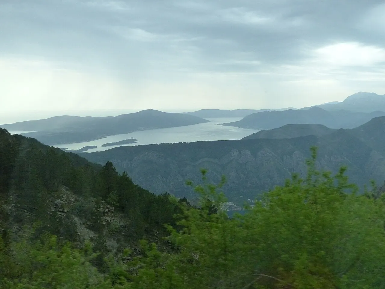
The Bay of Kotor — the Boka Kotorska — is often called Europe's southernmost fjord, though it is really a ria: a flooded river canyon that folds inland in four basins linked by narrow straits, with Kotor tucked into the deepest, most dramatic corner beneath the cliffs of Lovćen. A road runs almost the whole way around the water's edge, and tracing it is one of the great short drives in the Adriatic. From the car you read the bay the way it was built to be read — captains' towns strung along the shore, two islets off Perast, the pinch of the Verige strait where defensive chains were once strung, and the open run toward Tivat and the sea.
Set expectations on the driving itself, though, because this is a trip about stopping, not speed. The bay road is largely a single carriageway hugging the shore: scenic at every turn but narrow, winding, lined with parked cars and walkers, and genuinely slow — especially in summer, when tour coaches, cruise traffic and the heat all conspire. Distances look tiny on a map and take far longer than you expect. Drive defensively, never rush a blind bend, and treat the whole loop as a relaxed half- or full-day, not a quick spin. The reward is in the pull-ins and the towns, not the kilometres covered.
One more thing to settle before you start the engine: the Old Town is car-free, and parking near the walls is tight and pricey in season. Most bay bases offer easier parking than Kotor itself, so plan where you will leave the car at each stop rather than assuming a space. We keep volatile details — the ferry fare, parking charges, fuel and any seasonal road or viewpoint access — out of the prose and flag them to verify, because they all change. Check the current ferry running times and prices in particular before you build a day around the crossing.


Step 1 — Out of Kotor along the inner shore to Perast
Begin by getting the car clear of the walls. Leave from your parking outside the Old Town and head north along the inner bay shore through Dobrota, the leafy waterfront suburb that strings out along the water with bay-view villas, a flat promenade and quiet swimming spots. It is a gentle opening to the drive, the cliffs of Vrmac rising across the water and Kotor shrinking in the mirror. There are pull-ins and small coves along here if you want an early stop or a first swim.
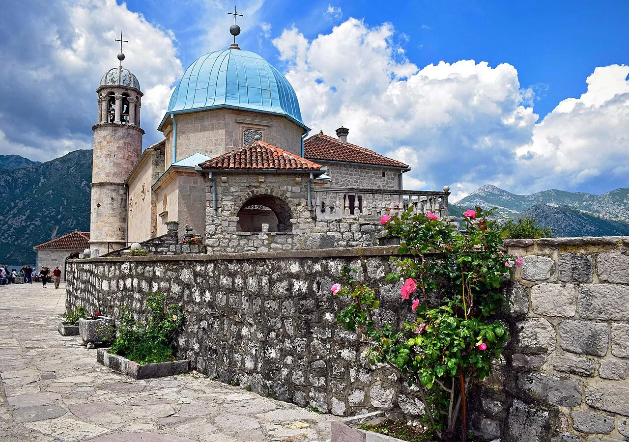
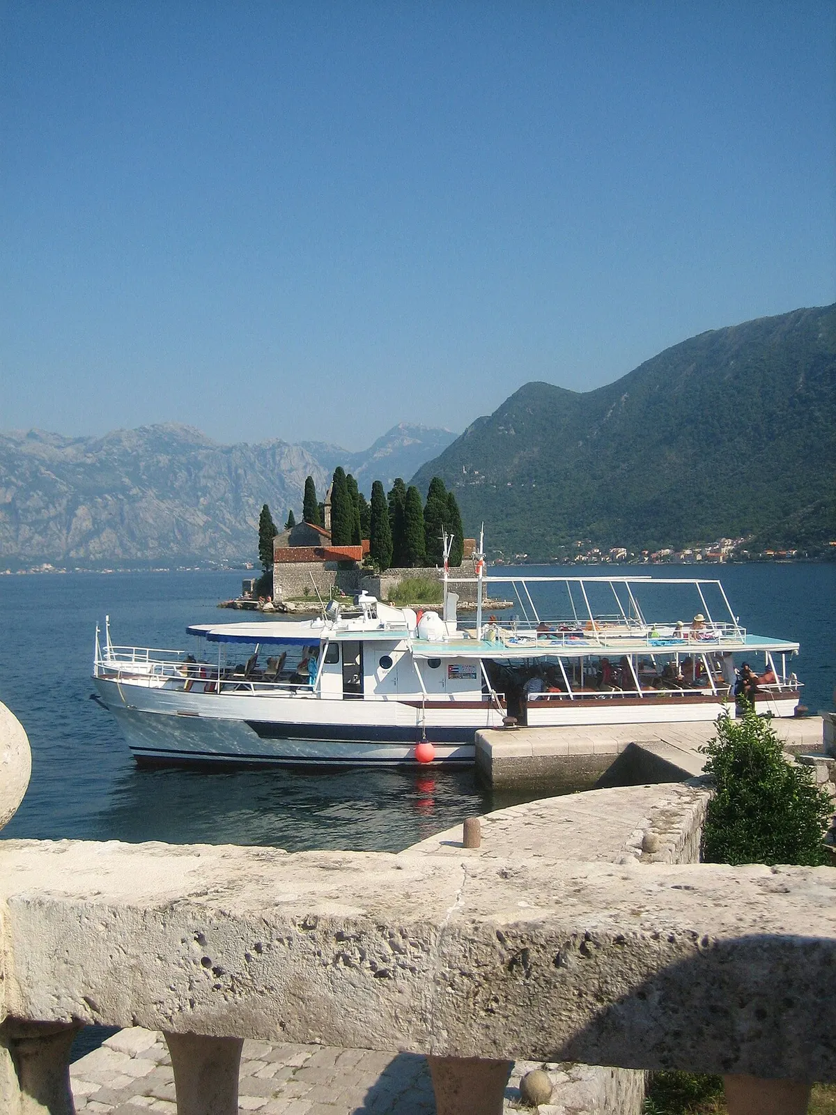
The road then curves around the basin toward Perast, the baroque captains' town that is the highlight of the inner bay. Cars are kept out of Perast itself — there is paid parking on the approach — so leave the car and walk down to the long stone waterfront facing its two small islands. From the quay, small boats run the short hop out to Our Lady of the Rocks, the man-made island church raised over centuries on sunken ships and votive stones. This is the one stop worth lingering over: a coffee on the waterfront, the boat to the island, the bell tower of St Nicholas above you. Go early or late to have it to yourself, as midday brings the bay's tour traffic.
- Leave the car outside the car-free Old Town and head north through Dobrota along the inner shore.
- Dobrota offers a flat promenade, bay-view villas and quiet coves for an early swim or stop.
- Park on the approach to car-free Perast, then walk to the waterfront and take a boat to Our Lady of the Rocks.
- Perast is the lingering stop — go early or late to dodge the midday tour traffic.
 Perast & Our Lady of the Rocks
The baroque captains' town and its island church — the heart of the bay drive.
 Dobrota Promenade
The flat waterfront stretch north of Kotor, with its coves and bay views.
Map pins
Map data © OpenStreetMap contributors · Tiles © OpenFreeMap
Step 2 — Risan and the Roman mosaics
Carry on around the head of the bay to Risan, the oldest settlement on the Boka and once an Illyrian and then Roman town. Its quiet, underrated highlight is a set of Roman floor mosaics, preserved in situ at the site of a Roman villa — among them a famous depiction of Hypnos, the god of sleep, thought to be unique in the region. It is a short, easy stop and a complete change of register from the baroque waterfronts: a reminder that the bay's history runs far deeper than its Venetian and captains' centuries. Verify the current opening hours and entry before you arrive, as the site keeps seasonal hours.
Risan sits at the inner corner of the bay, and reaching it marks the turn in your loop. From here you face the trip's one real decision: complete the full circuit by continuing all the way around the shore, or take the shortcut across the bay mouth on the ferry. Both have their merits, and the next step lays them out. Either way, Risan is the natural pause to stretch, grab a coffee, and decide which way the afternoon goes.
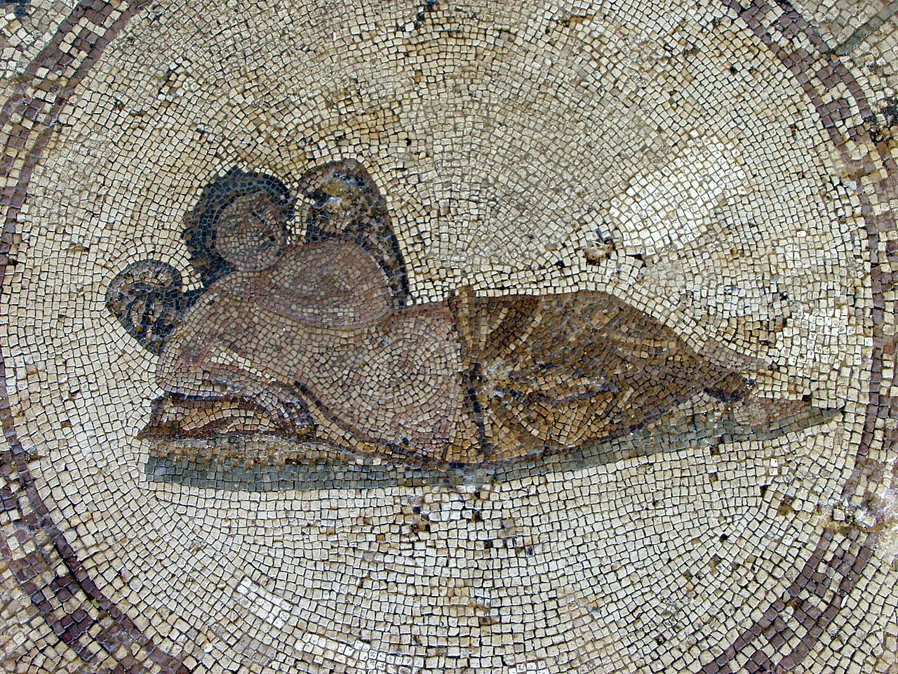
- Risan is the bay's oldest settlement, with preserved Roman floor mosaics — including a famous Hypnos.
- It is a short, easy stop and a deep-history counterpoint to the baroque towns — verify the seasonal opening hours.
- Reaching Risan marks the turn in the loop: from here, choose the full circuit or the ferry shortcut.
- A good place to pause, take a coffee and decide which way the afternoon goes.

Step 3 — The big choice: full loop or the Kamenari–Lepetane ferry
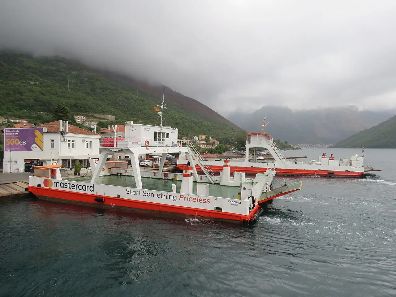
From the inner bay, the road continues out toward the bay mouth and the Verige strait, the 340 m pinch that is the narrowest point of the whole Boka. Here you reach the trip's defining junction. To complete the full loop entirely by road, you keep driving around the outer shore — a longer route that swings the long way around the bay. The great alternative is the Kamenari–Lepetane ferry, which cuts straight across the mouth of the bay in a few minutes and saves a substantial drive around. For anyone heading on to Tivat, Herceg Novi or the road toward Croatia, the ferry is the obvious, time-saving move.
The ferry runs frequently and is a small adventure in itself — a short, scenic hop across the narrows with the cliffs rising on both sides — but it is exactly the kind of service whose running times, frequency and fares shift, and queues can build in peak summer. Verify the current schedule and price before relying on it, and factor in a possible wait at busy times. If you are circling back to Kotor for the night, you might skip the ferry and simply retrace the inner shore, which is no hardship given the views. If you are pushing on across the bay, take the ferry and pick up the drive on the far side toward Tivat.
- At the bay mouth and the 340 m Verige strait, choose: the full road loop around, or the ferry across.
- The Kamenari–Lepetane ferry cuts across the bay mouth in minutes and saves a long drive around.
- It is the smart move if heading on to Tivat, Herceg Novi or Croatia — runs frequently, but queues build in peak summer.
- Verify the current ferry running times, frequency and fare before relying on it, and allow for a possible wait.

Step 4 — Tivat, the viewpoints and the run back to Kotor
If you took the ferry or completed the outer loop, the far shore brings you to Tivat, the bay's most modern town and home to Porto Montenegro, a glossy superyacht marina lined with restaurants, cafés and waterfront promenades. It is a complete contrast to the medieval Old Town and the baroque captains' houses — a good place for a relaxed lunch, a stroll along the quay among the yachts, or simply a coffee before the drive back. Tivat is also where the region's airport sits, which makes this a natural last stop if your road trip doubles as a journey out of the bay.
Save something for the heights on the way back. The roads that climb the Vrmac ridge between Tivat and Kotor, and the lower serpentines of the old Kotor–Lovćen road, open up the bay's most jaw-dropping viewpoints — the whole Boka spread out below, Kotor a tiny cluster at the foot of its cliffs, the water folding away in basins toward the sea. These pull-ins are the photographs you came for. Time the loop so you finish with the late-afternoon light on the bay, then drop back down to your parking outside the Old Town. Mind the bends on the descent, especially if cloud has come in, and let the slow, careful end of the drive be a feature, not a chore.
- Tivat and Porto Montenegro: a glossy marina, waterfront restaurants and a relaxed lunch stop — and the region's airport.
- On the way back, climb the Vrmac ridge or the lower Lovćen serpentines for the bay's best viewpoints.
- Time the loop to finish with late-afternoon light on the bay, then drop to your parking outside the Old Town.
- Drive the descent carefully, especially in cloud — the bends are tight and the views are distracting.
Driving the bay: parking, fuel and the small print
A few practicalities make or break a bay road trip. Parking is the recurring puzzle: the Old Town is car-free and spaces near the walls are tight and charged, so plan where you will leave the car at each stop — Perast has paid parking on its approach, Tivat has marina and town car parks, and the viewpoints have informal pull-ins rather than proper lots. Don't block the narrow bay road or private accesses. Fuel up before you start, as stations are not on every corner around the shore, and carry some cash for parking machines and the ferry, though cards are widely taken.
On the road itself, Montenegro drives on the right, and the bay road demands patience above all: it is narrow, twisting and shared with walkers, cyclists, parked cars and the occasional reversing coach. Keep your speed down, give way generously at pinch points, and never overtake on a blind bend. The whole loop is short in distance but long in time, so build in more hours than the map suggests and treat the slowness as part of the experience. If you would rather not drive the bends at all, a small-group or private bay tour covers the same route with someone else at the wheel — and the boat trips reach the same towns from the water.
- Plan parking at every stop — the Old Town is car-free; Perast and Tivat have paid car parks; viewpoints have pull-ins.
- Fuel up before you start, and carry some cash for parking and the ferry, though cards are widely taken.
- Drive on the right; the bay road is narrow and slow — keep speed down and never overtake on blind bends.
- The loop is short in distance but long in time — allow more hours than the map suggests, or take a tour instead.
Extending the drive: up to Lovćen, Njeguši and Cetinje
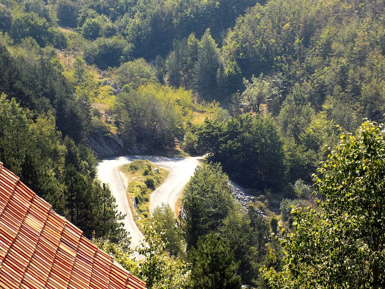
The bay loop is a satisfying half- or full-day on its own, but it also opens straight onto one of Montenegro's great drives. From the inner bay above Kotor, the old serpentine road climbs the mountainside in a famous sequence of switchbacks — the most-photographed view of the whole Boka is from these bends, with the Old Town a terracotta speck at the foot of its cliffs and the bay folding away below. The road climbs toward the mountain hamlet of Njeguši, the birthplace of the Petrović dynasty and the home of the prosciutto and cheese you have been eating all over the bay; many drivers stop here for a board of pršut and a coffee with a view.
Beyond Njeguši the road runs on into Lovćen National Park, with its mausoleum to the poet-prince Njegoš high on the peak, and down to Cetinje, the atmospheric old royal capital with its monastery and museums. Done as an extension of the bay loop, this turns a relaxed shore drive into a bigger mountain day, so weigh it against your time and appetite for hairpins — the serpentine is spectacular but demands a confident driver and a cool head, and is best avoided in low cloud. If you would rather keep the day gentle, simply finish the bay loop and save the mountain for another trip; the cable car from the Kotor side now reaches similar heights with far less driving.
- The Kotor serpentine climbs to the bay's most famous viewpoint and on toward Njeguši and Lovćen.
- Njeguši is the home of the bay's prosciutto and cheese — a classic stop for a board with a view.
- Beyond lie Lovćen National Park and the old royal capital, Cetinje — a bigger mountain day.
- The hairpins demand a confident driver; the cable car reaches similar heights with less driving.


No car? Doing the bay without driving
You do not actually need a car to see the bay, and for many visitors not driving is the more relaxing choice. The regional buses run the shore road frequently in season, and the Kotor–Risan line is the key one for this route: it passes through Dobrota and Perast, so you can ride out to the captains' town, take the island boat, and bus back without ever touching a steering wheel. From Kotor's bus station, services also reach Tivat, Herceg Novi and Budva, covering most of the loop's stops piecemeal. It is slower and less flexible than a car, but it removes the parking headache entirely and lets everyone enjoy the views.
The other car-free way to read the bay is from the water. Group and private boat tours leave from the Kotor waterfront and string together the same towns and islands the road passes — Perast, Our Lady of the Rocks, the inner basins — often with swim stops the road can't offer, and with none of the bends. A boat tour in one direction and the bus in the other makes a fine no-car version of the loop. And for the high viewpoints, the cable car and organised Lovćen tours stand in for the serpentine drive. Mix and match the bus, the boat and a tour, and the whole bay is open to you without a hire car.
- The Kotor–Risan bus passes Dobrota and Perast — ride out, take the island boat, and bus back.
- Buses from Kotor's station also reach Tivat, Herceg Novi and Budva, covering the loop piecemeal.
- Boat tours read the same bay from the water, with swim stops and none of the bends.
- For the heights, the cable car and Lovćen tours stand in for the serpentine drive.

Your bay road trip at a glance
Use this card to shape a bay loop, then confirm the moving parts. Verify the volatile details — the Kamenari–Lepetane ferry running times and fare, parking charges, fuel, and any seasonal road or viewpoint access — on the day or from official sources, as they all change.
- The route: Kotor → Dobrota → Perast (and Our Lady of the Rocks) → Risan → the bay mouth → ferry or full loop → Tivat → viewpoints → Kotor.
- Shortcut: the Kamenari–Lepetane ferry across the bay mouth saves a long drive around — verify times and fare.
- Key stops: Perast and the island church, Risan's Roman mosaics, Tivat's marina, the high bay viewpoints.
- The Old Town is car-free; plan parking at every stop — Perast and Tivat have paid car parks.
- Drive slowly: the bay road is narrow, winding and far slower than the map suggests. Allow a relaxed half or full day.
- Prefer not to drive the bends? A bay tour or the boat trips reach the same towns.
- Ferry fares, parking, fuel and access all change — verify before you set off.

Bay of Kotor Scenic Drives
The best drives around the Bay of Kotor: the shoreline loop through Perast and the captains' villages, the white-knuckle Kotor–Lovćen serpentine, the Kamenari–Lepetane ferry shortcut, plus photo stops, summer traffic and driving cautions for each.
Read guide
Kamenari–Lepetane Ferry Guide
The Kamenari–Lepetane car ferry across the mouth of the Bay of Kotor: where it runs, when it saves real time versus driving around, how to use it step by step, what to verify, and when the scenic shoreline drive is the better choice.
Read guide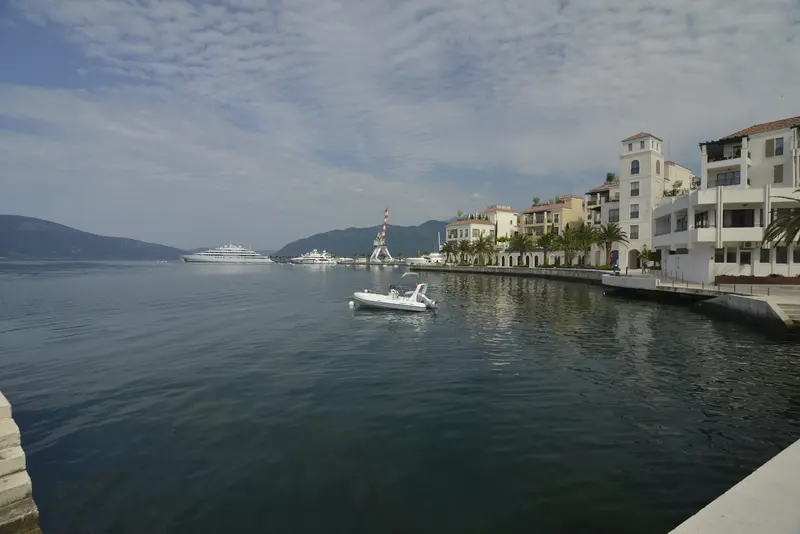
Tivat & Porto Montenegro from Kotor
How to day-trip from Kotor to Tivat and Porto Montenegro: getting there by bus, taxi, car or boat, what the glossy marina town is actually like, its beaches and airport-timing angle, and an honest verdict on when Tivat is worth a Kotor day.
Read guideMore in Itineraries
6
A Weekend in Kotor
A Friday-evening-to-Sunday plan for the Bay of Kotor built around hotel-area logic, sunset views, boat timing and relaxed meals: arrive and settle in, give Saturday to the Old Town and the walls climb, take Sunday onto the water before you leave — the well-chosen short break, not a sight-ticking marathon.
Read guide
Kotor for Couples: A Romantic Itinerary
A romantic two-to-three day Kotor route built around slow bay-view mornings, the fortress at golden hour, Perast and a private boat, waterfront dinners and the lamplit lanes once the ships leave — the unhurried, golden side of the Boka, planned for two.
Read guide
Kotor on a Budget: A Low-Cost Itinerary
A lower-cost Bay of Kotor plan that leans on free sights, local buses, market and bakery food, self-guided walks and one or two selective paid splurges — how to do the Old Town, the bay and the views well without spending much, and where it is worth paying.
Read guide
Kotor Rainy Day Itinerary
A full wet-weather day in Kotor that still feels like a day: a slow indoor morning of museums and churches inside the walls, a long café-and-konoba lunch, a covered-courtyard or hotel-spa afternoon, and a moody bay option for when the sea stays calm.
Read guide
Kotor with Kids: A Family Itinerary
A family-paced Bay of Kotor plan built around short flat walks, the cats and the Cats Museum, the aquarium, calm beaches, safe boat choices and low-stress meals — with honest notes on what the walls climb and the summer heat mean for children, and how to keep everyone happy.
Read guide
Kotor Without a Car Itinerary
How to enjoy Kotor and the Bay of Kotor entirely car-free: a walkable Old Town, the bus station just outside the walls, local buses along the bay, boats to Perast, taxis to fill the gaps, and honest verdicts on which day trips work without a car.
Read guide